


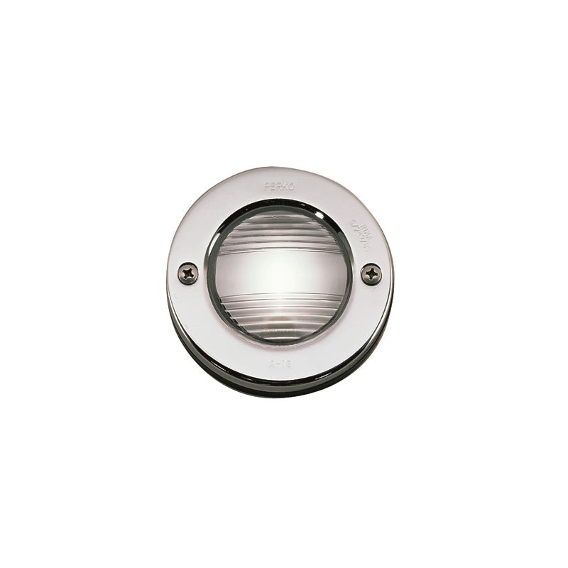
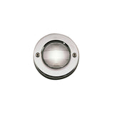
STERN LIGHT TRANSOM/MNT
- $85.49
$94.89- $85.49
- (-10%)
- Unit price
- per
MPN :
SKU:
DM-543771
Availability:
Out Of Stock
Product type:
Navigation Lights
Please hurry! Only 0 left in stock
Subtotal:
$85.49
Couldn't load pickup availability


Description
xCMAP PREC CONT HDALABAMA
Navigate Alabama's waters with unparalleled accuracy using C-MAP Precision Contour HD charts. This advanced charting solution provides incredibly detailed bathymetric data, offering high-resolution depth contours that are crucial for safe navigation and effective fishing. Whether you're exploring coastal areas, inland lakes, or river systems across Alabama, these charts deliver the critical information you need to confidently plan your routes and find productive fishing spots.
- Key Features
- High-Definition Depth Contours: Experience extremely detailed and accurate depth soundings, allowing for precise understanding of underwater terrain.
- Comprehensive Coverage: Provides extensive charting for Alabama's diverse waterways, including coastlines, major lakes, rivers, and channels.
- Fishing Spot Identification: Reveals subtle underwater features like drop-offs, humps, and channels that are often overlooked, helping anglers locate prime fishing locations.
- Enhanced Navigation Safety: Aids in avoiding submerged hazards and navigating shallow areas with greater confidence.
- Dynamic Tides and Currents: Access tide and current information to further optimize your fishing and cruising strategies.
The C-MAP Precision Contour HD charts for Alabama are more than just maps; they are powerful tools that enhance your experience on the water. The detailed contour lines allow for a precise visualization of the lakebed or seafloor, enabling fishermen to pinpoint areas where fish are likely to congregate. Boaters can use this detailed data to plan safer routes, especially in unfamiliar waters or areas with known submerged obstacles. The clarity and accuracy of the data presented are a testament to C-MAP's commitment to providing high-quality navigational aids.
This charting solution is ideal for a variety of marine activities, from recreational boating and fishing to professional navigation. The advanced data allows for more efficient route planning, reducing fuel consumption and travel time. By providing a deeper understanding of the underwater environment, C-MAP Precision Contour HD charts empower users to make better decisions, whether they are seeking the perfect fishing spot, navigating a busy channel, or simply enjoying a leisurely cruise. The detailed information helps to minimize risks and maximize enjoyment, making every outing on Alabama's waters more successful and secure.
Product Specifications
| Specification | Value |
|---|---|
| Chart Type | Precision Contour HD |
| Region | Alabama |
| Data Detail | High-definition depth contours |
| Coverage | Coastal waters, inland lakes, rivers, and channels of Alabama |
| Features | Detailed bathymetry, fishing spots, navigation aids, tide and current data |
| Compatibility | Wide range of GPS chartplotters (check specific model) |
| Format | Electronic Chart (e.g., C-MAP MAX-N, C-MAP Genesis) |
Related Products
Example product title
- $85.49
$94.89- $85.49
- (-10%)
- Unit price
- per
Example product title
- $85.49
$94.89- $85.49
- (-10%)
- Unit price
- per
Example product title
- $85.49
$94.89- $85.49
- (-10%)
- Unit price
- per
Example product title
- $85.49
$94.89- $85.49
- (-10%)
- Unit price
- per
Example product title
- $85.49
$94.89- $85.49
- (-10%)
- Unit price
- per
Example product title
- $85.49
$94.89- $85.49
- (-10%)
- Unit price
- per
Example product title
- $85.49
$94.89- $85.49
- (-10%)
- Unit price
- per
Example product title
- $85.49
$94.89- $85.49
- (-10%)
- Unit price
- per
Example product title
- $85.49
$94.89- $85.49
- (-10%)
- Unit price
- per
Example product title
- $85.49
$94.89- $85.49
- (-10%)
- Unit price
- per
Recently Viewed Products
Example product title
- $85.49
$94.89- $85.49
- (-10%)
- Unit price
- per
Example product title
- $85.49
$94.89- $85.49
- (-10%)
- Unit price
- per
Example product title
- $85.49
$94.89- $85.49
- (-10%)
- Unit price
- per
Example product title
- $85.49
$94.89- $85.49
- (-10%)
- Unit price
- per
Example product title
- $85.49
$94.89- $85.49
- (-10%)
- Unit price
- per
Example product title
- $85.49
$94.89- $85.49
- (-10%)
- Unit price
- per
Example product title
- $85.49
$94.89- $85.49
- (-10%)
- Unit price
- per
Example product title
- $85.49
$94.89- $85.49
- (-10%)
- Unit price
- per
Example product title
- $85.49
$94.89- $85.49
- (-10%)
- Unit price
- per
Example product title
- $85.49
$94.89- $85.49
- (-10%)
- Unit price
- per
- Choosing a selection results in a full page refresh.